San Andreas Fault earthquake wakes greater Los Angeles
By David Jacobson, Temblor
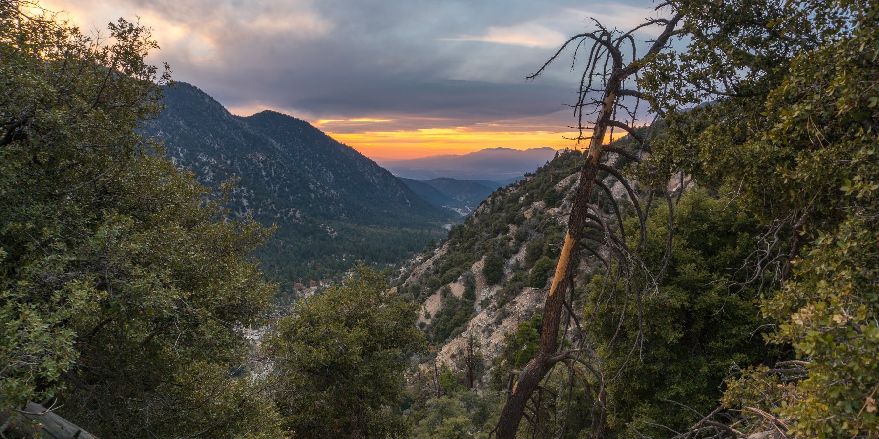
At just past 2 a.m. local time, a M=3.4 earthquake along the San Andreas Fault just east of Los Angeles woke residents from their nightly slumber. At 9 a.m. this morning, there were 436 felt reports on the USGS website. Having said that, based on the shaking, it is highly likely that many more felt it. Around the epicenter, there was moderate shaking, with weak shaking felt in and around Riverside.

This earthquake occurred in the San Andreas Fault Zone (SAFZ), along the San Bernardino Mountains section. While the Mill Creek Fault (Within the SAFZ) is closest to the earthquake's epicenter, based on the 10 km depth, this quake likely occurred along the main strand of the San Andreas. According to Fuis et al., 2012, within this portion of the San Andreas Fault, it dips approximately 37° to the northeast. This is an extremely shallow dip compared to other locations where it becomes nearly vertical.
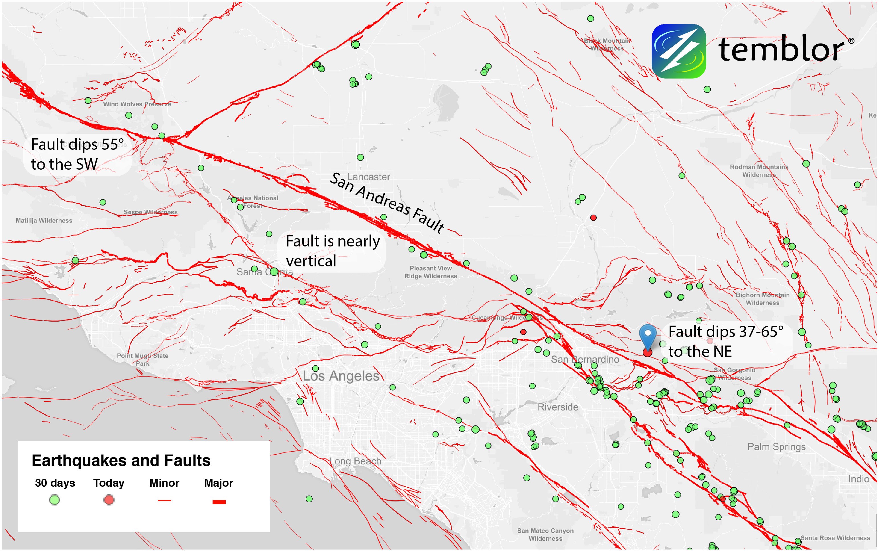
While most people only focus on where faults are at the surface, the subsurface geometry of the southern San Andreas is quite intricate. As the San Andreas weaves its way through Southern California, it has many bends separated by straight sections. While in the straight portions, like along the Mojave Desert, fault dips often exceed 80°, in the bends, the story is quite different. Subsurface magnetic data shows that in areas such as San Bernardino and Indio, the fault dips between 37°-65° to the northeast. This is a striking difference compared to the dip of the San Andreas within the western Traverse Range, where it dips approximately 55° to the southwest.
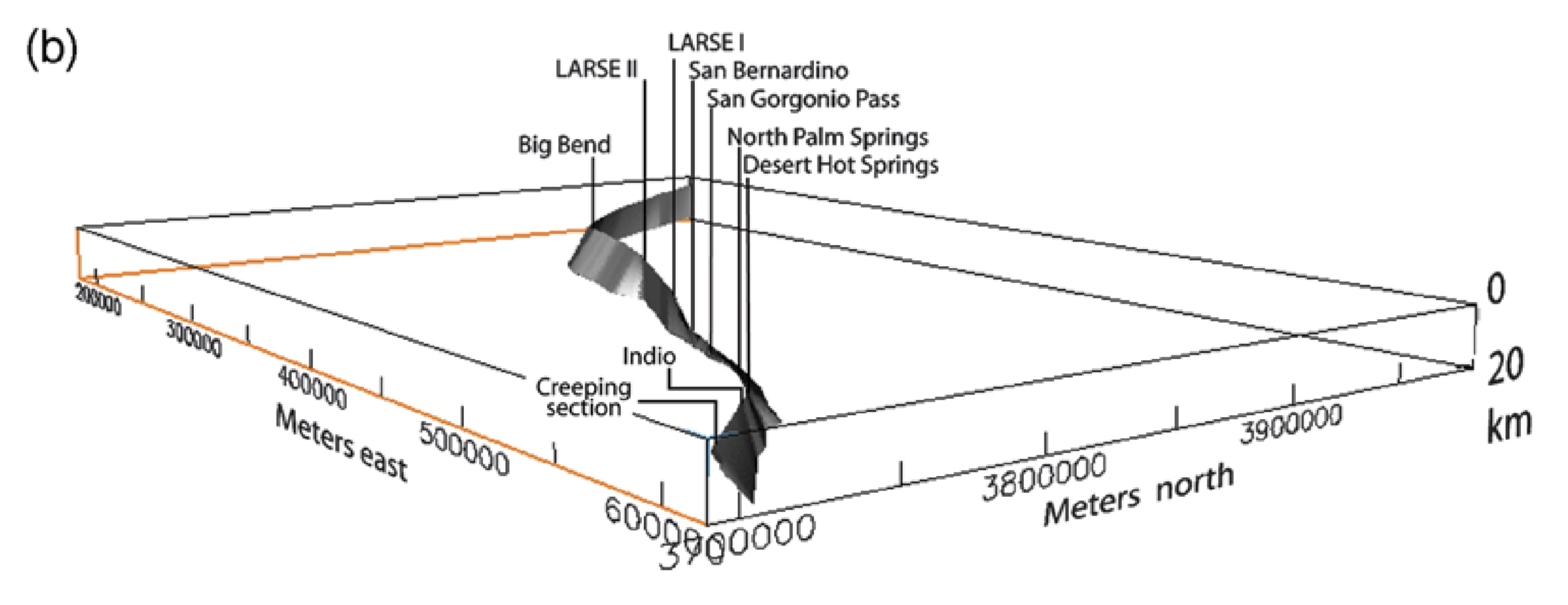
Because of these variable dips, at depth, the southern portion of the San Andreas has a shape described as a crude propeller. In addition to being an interesting fact, this shape also has a profound effect on seismic hazard. When a fault ruptures, either side of it has a name, the hanging wall, or the footwall. This is determined by fault dip (See figure below). While both sides look similar, shaking within them is often very different. Studies have shown that shaking within the hanging wall can sometimes be more than double that within the footwall. This means that at sites equally distant from a fault, your hazard is higher if live on the hanging wall of a fault. This highlights how important location is to determining what your hazard is.

Sources
Fuis et al., Bulletin of the Seismological Society of America, Vol. 102, No. 1, pp. 236–251, February 2012, doi: 10.1785/0120110041
USGS
http://temblor.net/earthquake-insights/san-andreas-fault-earthquake-wakes-greater-los-angeles-2505/
--
__._,_.___
No comments:
Post a Comment